 |
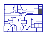
Yuma County, Colorado
Land Survey Townships
|
|
|
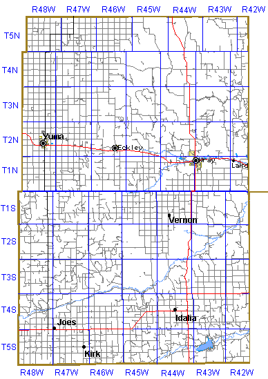
The Yuma County land survey grid is based on the 6th Principal
Meridian (in eastern Kansas) and a Baseline at 40° North (the heavy
blue line running east to west in the middle of the map shown below.)
Townships 6 miles tall and 6 miles wide are numbered as Townships North
or South of the Baseline and as Ranges West of the Principal
Meridian. Township and Range boundary lines are the dark blue lines shown
on the map. The grey, black and red lines on the map show todays road
network - Yuma County Roads, Colorado and US Highways. The light blue
lines are streams.
The township in the far northwestern corner of Yuma County is Township 5 North Range 48 West of the 6th PM. It would be abbreviated as T5N R48W. Vernon is in T1S R44W. The Colorado-Kansas and the Colorado-Nebraska border (102° West) runs through the middle of Range 42 West. The townships in Range 42 West are shared with the neighboring counties in Kansas and Nebraska.
|
 |
| |
NOTE: While Yuma County was established in 1889, the half of
the county south of the Baseline wasn't added until 1903. Prior to that
it was part of Arapahoe County.
More about land survey section legal
descriptions.
The base Yuma County map used for this map was downloaded from the Tiger Mapping Service of the US Census Bureau then the township survey grid was added. The maps on this page are copyrighted 2000, Lee C Zion e-mail lzion@plains.net, All Rights Reserved.
Go to Yuma County Place Name Table
Go to Yuma County Historical Map
Go to Yuma County School District Map
Go to Yuma County 1920 Precinct Map