The town of Alamosa was incorporated in 1878, It was established as a railroad town on the Rio Grande River when the Rio Grand Railroad reached there in June of 1878. It became the rail hub for the San Luis Valley which lead to it's rapid growth and becoming the largest city in the valley. Alamosa is Spanish for Cottonwood, groves of Cottonwood trees grow along the banks of the Rio Grande. It was the last County in Colorado to be approved taking place on Saturday, March 8, 1913. What is now Alamosa county was the northern part of Costilla County and Conejos Counties which were established in 1876 when Colorado became a state. William H. Adams (for whom Adams State Collage in Alamosa is named) was a state senator from Conejos County and introduced the bill for Alamosa to be established as a county. There are links on the resources page to sites with more information about Alamosa and the San Luis Valley. Below is a map of the San Luis Valley in 1887 before Alamosa county was created.
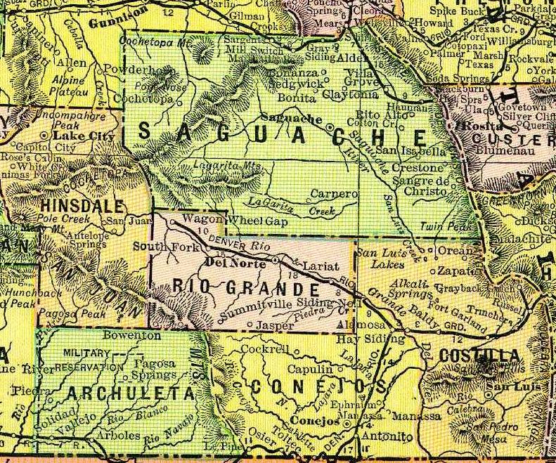

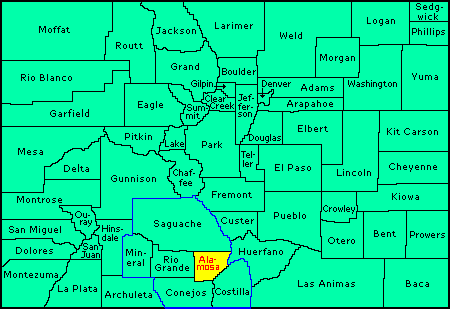
Alamosa is located in the south central part of the state in the San Luis Valley about 40 miles north of New Mexico. The blue outline on the map is the San Luis Valley.
The other counties around Alamosa are: To the North
Saguache, To the East on the other side of the Sangre De Cristo Mountains Huerfano, To the South East Costilla, To the South Conejos, To the West Rio Grande. West of Rio Grande Co. is Mineral. The links will take you to the CoGenWeb sites for those counties.
The six counties, Alamosa, Conejos, Costilla, Mineral, Rio Grande and Saguache are in the San Luis Valley, which is surrounded by the Sangre De Cristo mountains on the East, and the San Juan Mountains on the West. The San Juan's are part of the Continental Divide.
Visit the Resources Page to find links to learn about Alamosa and the San Luis Valley. The San Luis Valley actually extends into New Mexico in Rio Arriba and Taos counties.
The Rootsweb list Coalamos is now being used as the San Luis Valley wide list. This list covers the six counties of the San Luis Valley; Alamosa , Conejos, Costilla , Mineral, Rio Grande & Saguache County. This has been done so researchers can have one list for the San Luis Valley counties. Residents of the valley often lived in more than one county. You may post queries to this list, but PLEASE NOTE: NO query OR surname will be picked up by the County Coordinators for posting to the county pages. If you wish to post a query or surname on the County Pages, please use the RootsWeb Message Boards for that county or contact the coordinator for that county.
If you would be interested in joining this list, you may do so by sending a message with the word "subscribe", minus the quotes, in the body of the message to: COALAMOS-request@rootsweb.com.