Boulder County Communities
Towns and Town Histories
| TOWN | HISTORY | TODAY |
|---|---|---|
| Allenspark | Est. 1896; named for Alonzo N. Allen who discovered gold nearby in 1864; stage stop between Ward and Estes Park. | Community, 2000 population 496 |
| Altona | Originally called Modoc (1874–79), Altona was a post office and business point near the mouth of Left Hand Canyon until 1916. Occupants included George Bader and Samuel Arbutnot. Elevation 5599 ft.; latitude 400802N; longitude 1051656W. | Ghost town |
| Balarat | Post Office (1879–1887). Elevation 7480 ft.; latitude 400933N; longitude 1052345W. | Ghost town |
| Big Five | Gold & silver mine (longitude 400424N, latitude
1053024W). Inactive coal mine (latitude 395804N, longitude 1051117W). |
Ghost town |
| Boulder | First called Boulder City. Elevation 5535 ft. County seat of Boulder County, located near foothills on Boulder Creek. Population grew from 600 (1871) to 94,673 (2000). | County seat; home of the University of Colorado; 2000 population 94,673 |
| Canfield | Post Office 1878–1906; station on D&BV railroad 1¼ miles west of Erie; latitude 400313N; longitude 1050427W. | Ghost town |
| Cardinal | Wagon stop mining camp established in 1870. Post office 1905–1919. Elevation 8980 ft.; latitude 395811N; longitude 1053250W. | Ghost town |
| Caribou | Ghost town | |
| Copperock | Post Office 1892–1915. | Ghost town |
| Crisman | Post Office 1876–1918; elevation 6360 ft.; latitude 400227N; longitude 1052139W. | Ghost town |
| Davidson | Post Office 1873–1878. Station on C.C.R.R. 8 miles from Boulder. Included Davison Coal and Iron Co., Escelior Coal Co., general merchandise, and hotel. | Ghost town |
| Delphi | Post Office 1895–1898; see Wallstreet. | |
| Eagle Rock (Eagle Creek) | Mining camp with hotel and multiple mines. Post Office 1876–1877. | Abandoned |
| Eldora | Est. 1897, Inc. 1898; previously known as Eldorado. Elevation 8641 ft.; latitude 395655N; longitude 1053348W. | Community |
| Eldorado Springs | Est. 1930; previously known as Hawthorne. Elevation 5762 ft.; latitude 395557N; longitude 1051635W. | Community; 2000 population 557 |
| Erie | Straddles the Boulder/Weld County line. Original townsite was in Weld County. | |
| Gold Hill | Community; 2000 population 210 | |
| Gorham | Post Office 1899–1942 (see also Marshall). | Renamed |
| Gresham | Post Office 1895–1912; elevation 8444 ft.; latitude 400825N; longitude 1052554W. | Ghost town |
| Highland | RR Stop 1892–1959; elevation 5136 ft.; latitude 401420N; longitude 1050458W. | Community |
| Hygiene | Established 1861; Post Office 1883. Reverend Jacob S. Flory built Hygiene and was first postmaster. Elevation 5097 ft.; latitude 401119N; longitude 1051049W. | Community |
| Jamestown | Est. 1867, Inc. 1883. Early mining town on James Creek. Elevation 6929 ft.; latitude 400656N; longitude 1052317W. | Community; 2000 population 205 |
| Keysport | Mining settlement active in 1870 on Beaver Creek. Listed residents included Alfred Tucker and others. | Ghost town |
| Lafayette | Est. 1889, Inc. 1890; founded by Mary Miller and named for her husband Lafayette Miller. | Community; 2000 population 23,197 |
| Liggett | RR Stop (1969 map); elevation 5059 ft.; latitude 400242N; longitude 1050800W. | Ghost town |
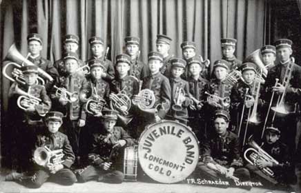
| Longmont | Early railroad and stage hub. Est. 1871, Inc. 1873; elevation 4942 ft. | Community; 2000 population 71,093 |
| Louisville | Founded 1878 by Louis Nawatny. Coal mining roots beginning in 1877. Elevation 5337 ft. | Community; 2000 population 18,937 |
| Lyons | Mining camp as early as 1858; Est. 1882; Inc. 1891; elevation 5362 ft. | Community; 2000 population 1,585 |
| Magnolia | Mining district center. Post Office 1876–1920; elevation 7238 ft.; latitude 395938N; longitude 1052153W. | Community |
| Marshall | Old mining town. Est. 1860–1878; elevation 5509 ft.; latitude 395720N; longitude 1051345W. | Community |
| Nederland | Originally Brownville (1870). Est. 1871, Inc. 1874. Elevation 8233 ft.; latitude 395741N; longitude 1053037W. | Community; 2000 population 1,394 |
| New Market | Ghost town | |
| Niwot | Settled as early as 1859; established 1872. Named for Chief Ni-Wot (“Left Hand”). Post Office 1873; RR station 1875. | Community; 2000 population 4,160 |
| Orodelfan | Post Office 1876–1881; also called Orodell, Maxwell's Mill, Hortonville, Hunt's Concentration Works. | Ghost town |
| Pella | Original townsite near present-day Hygiene. | Ghost town |
| Rowena | Est. 1894; Post Office 1894–1918; elevation 7372 ft.; latitude 400437N; longitude 1052320W. | Community |
| Salina | Mining town with daily stages to Boulder, Gold Hill, and Sunshine. Post Office 1874–1925; elevation 6581 ft. | Community |
| Santa La Saria | Latitude 395746N; longitude 1053034W. | Ghost town / inactive mine |
| Sugar Loaf | Mining district 10 miles west of Boulder. Post Office 1867–1944; elevation 7842 ft.; latitude 400101N; longitude 1052424W. | Community |
| Sunshine | Mining town in Gold Hill district. Post Office 1875–1913; Inc. 1885; elevation 7160 ft.; latitude 400357N; longitude 1052158W. | Community |
| Superior | Est. 1896, Inc. 1904; elevation 5490 ft. Population grew from 255 (1990) to 9011 (2000). | Community |
| Tungsten | Post Office 1916–1949; peak population 20,000; elevation 8002 ft.; latitude 395819N; longitude 1052832W. | Ghost town |
| Valmont | On the Denver & Boulder Valley Railroad. Post Office 1865–1901; elevation 5183 ft.; latitude 400155N; longitude 1051250W. | Community |
| Wallstreet | Originally named Delphi; name changed 1898. Post Office 1895–1921; elevation 6878 ft. | Ghost town |
| Ward | Est. 1863 as Ward District; renamed Ward 1894; Inc. 1896; elevation 9160 ft. | Community; 2000 population 169 |