Montrose County COGenWeb
COGenWeb a proud partner of USGenWeb
Olathe

Olathe is in the heart of the Uncompahgre Valley on the western slope of Colorado along U.S. Highway 50 halfway between Montrose and Delta, Colorado. Olathe follows the typical western Colorado settlement pattern of river-railroad-highway. Sitting at 5,346 feet above sea level, Olathe is surrounded by fertile mesa lands such as the Ash, High and East Mesas. Primarily the Town provides goods, services, and housing for its agricultural community. The high mountain barriers surrounding Olathe afford the valley uniform weather and lower wind velocity. Mild winters with little snow and summers with cool nights are major assets. Average annual snowfall is 10.4 inches with an average temperature of 29.1 degrees Fahrenheit in January. The average highest temperature in July is 93 degrees. There are approximately 250 days of sunshine in the area. The average annual rainfall is 8.8 inches. Olathe has a comfort index of 76 which represents a measure of comfort or discomfort humidity and temperature ranges in Colorado. The ultraviolet or UV index in Olathe is rated 6 which indicates a medium risk of exposure to the sun's ultraviolet rays at altitude on sunny days.
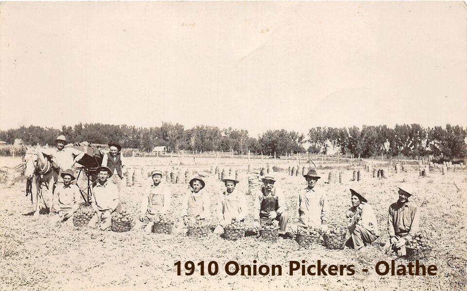 1910 Onion Pickers
North/slightly west of Montrose, the farming community of Olathe was established in 1896. Today the Olathe area is known for its diverse fruit and vegetable production, with onions, sweet corn and a variety of tree fruit grown in abundance.
My grandparents grew onions on their 40 acre farm for many years. While my grandmother passed in 1985, the land continued to be leased to neighbors to continue growing onions.
Sources: Town Of Olathe
This page was